What is GIS ?
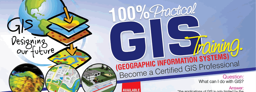
GIS stands for Geographical Information System. A Geographical Information System (GIS) is a framework which is used to gather, manage, and analyze data. GIS support integration of many types of data. It organizes layers of information into visualization and also analyzes spatial location. It uses maps and 3D scenes to visualize data. GIS has a unique capability which reveals deeper insights into data, such as relationships, patterns, and situations helping users make smarter decisions.
Many organizations in virtually every field are using GIS to make maps which helps to communicate, perform analysis, share information, and solve complex problems.
It could be said that any digital data that contains location-based information is, in fact, a GIS. This location information in the GIS industry could be an address, coordinates containing latitude and longitude or complex three-dimensional geometry.

GIS helps to connect data with geography. GIS makes it easy to understand what belongs to where. You don’t fully understand your data until you see how it relates to other things in a geographic context, where GIS helps.
In short term, Geographic Information Systems (GIS) really comes down to just 4 simple ideas. The main primordial functions of a GIS are below :
- Create geographic data
- Manage geographical data.
- Analyze geographical data
- Display geographical data on a map.
There are numerous ways in which GIS is used across different industries. A few examples are:
Identify Problems
GIS can illuminate issues that are driven by geography. When data is well-mapped, this map of opioid prescription claims reveals the geographic patterns that emerge.
Monitor Changes
People often say that a picture tells a thousand words. A map contains thousands of pictures. Since GIS displays the map data visually, it is helpful to the geo researchers to monitor changes.
Manage and respond to events
GIS brings real-time situational awareness. In the case of natural disasters, GIS helps to manage and respond to those events.
Perform Forecasting
People use GIS to forecast traffic. Forecasting may subject to the traffic is expected to worsen or improve over a period of time.
Set Priorities
GIS makes it easy to set priorities which are based on the spatial analysis. For example, by analyzing crime patterns, public safety officials may identify target areas and have a special plan in those areas.
Understand Trends
GIS makes it easy to gain insight into data that might be missed in a spreadsheet. It helps to understand trends.
GIS technology uses geographic science with tools for understanding and collaboration. GIS helps people reach a common goal i.e to gain actionable intelligence from all types of data.
How doe GIS work?
GIS is a computer system which is used for capturing, storing, checking, and displaying data related to positions on Earth’s surface. GIS can help individuals and organizations better understand spatial patterns and relationships by relating seemingly unrelated data.
What are the advantages of GIS?
GIS can visualize spatial information. It creates the maps with the images shown. It is used for a vast range of tasks involving geography. It provides solutions for the problems and it can model seismic activity precisely.
What careers use GIS?
- Geographer. …
- Cartographer/Photogrammetrist. …
- Urban /Regional Planner. …
- Surveyor.
- Civil engineers
- Researchers and students
What is a GIS Technician salary?
The potential salary of a GIS professional varies depending on several factors such as the location of the job, the title, and related experience. With reference to the international market, GIS jobs pay at least $11/hour as a GIS Intern or GIS Technician. Salary of GIS Analyst ranges from $43,282 to $51,228 with the average base salary of $47,608.
Is GIS a growing field?
One of the fastest growing fields in IT is GIS. The demand is growing worldwide and in the international market. GIS is available everywhere and it is a great career option for people who enjoy working with “big data” to produce interesting results and who are detailed oriented. Someone who builds a career in this field can be reasonably assured of a good career path.
What is GIS training?
GIS training gives you a detailed idea about the fundamental concepts of GIS and knowledge about spatial analysis techniques. GIS training gives practical knowledge of GIS. GIS training gives you detailed knowledge about GIS software which enables you with the use of GIS software; find and organize geographic data working with GIS maps, and generate information for decision making in the geographical grounds.
Pre-requisites for GIS Training
There are no prerequisites to join GIS training. Being computer literate and little knowledge on database is an advantage. However, one can still start from the very beginning.
Job Positions after GIS training
GIS Intern
Intern is a hands-on job training which you need to achieve almost every higher level (Technician, Analyst, etc.). The best way to achieve the job title is through an internship. Internships are mostly part-time jobs which are low paying but they are the best way to get further GIS training and to develop your GIS skills in a real-world setting. After training, you can join GIS intern programs like,
• Internships in GIS
• Impressions of a GIS Intern
GIS Technician/Specialist
1-2 years hand on experience with GIS based software is required to be a GIS Technician / Specialist. After an internship, you should be able to aim for these types of jobs. Both job positions are journey level job positions.
GIS Analyst
At least 2-3 years of experience with GIS based software is required to be a GIS Analyst. You may need to perform more complex analyses and RDBMS at this level. In addition, an analyst may also require a fair amount of programming experience.
GIS Coordinator or Manager
Depending on the company or agency, usually after the 5-6 years of experience in the field, you can be a GIS coordinator or manager. The manager also requires to have budgetary and project management experience
GIS Training in Nepal
Considering the wider scope of geographic information system skills Broadway offers career-oriented GIS training in Nepal to produce capable and competent GIS experts. The training course covers knowledge on handling specific GIS software to develop analytical maps and analyze spatial data in making a quality decision.
Related link – GIS Training in Nepal


